


Right as I began to empty the contents of the tent bag on the ground, snowflakes started to come down with a flurry. “No, no, no”, I whined aloud in disappointment, imagining the freezing night ahead after an exhausting five days of trekking.

I thought about my little remaining funds and the Raicho Onsen (Ptamargin Onsen) which I passed earlier in the day when I first arrived to Murodo Plateau. I smiled at the thought of onsen and, in less than three minutes, I had everything packed up, and I was on my way back down to heaven.
After a hot steaming Hinoki bath and ramen dinner, I wondered about Simon, my new friend I met on the trail. We had planned to climb Tateyama together early the next day. He had planned to stay in his tent, and I hoped he wouldn’t freeze too much camping at 2,500 meters.
The next morning, the green mountain I had seen during the day had been blanketed in white. It looked as if it was straight out of a fairy tale. I met Simon at a picnic table as he was drinking coffee and speaking to another hiker. He gravely informed us the snow had frozen over the trail, and an older woman hiker had slipped and fallen to her death. As I listened, the temperature seemed to drop a notch lower.
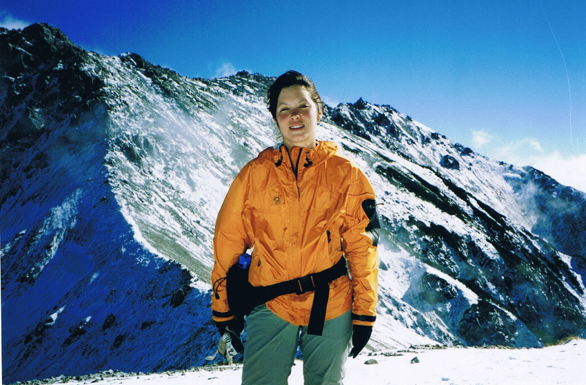
The lower trail definitely was crunchy with snow and ice but manageable until the last couple of hundred meters. There were gnarly rocks under foot, and I came upon the occasional chain handholds to cross tricky sections. In the summer this would be no sweat but, with ice below and thoughts of the poor woman, I felt like a tightrope walker.
At last I arrived at the shrine of Mt. Onanji; happy to be there in one piece, but not in any spirit to stay too long. I said a little prayer, thanking the gods of Oyama and the mountain priest which blessed me the day before for my safe journey.
Trail Tips
In the fall, snow can fall without much warning, so be prepared to stay in a hut rather than a tent if the weather changes. Crampons and a hiking stick may come in handy from late September.

MOUNTAIN STATS
Mountain: Tateyama
Difficulty Level: 3 out of 5
Location: Toyama / Nagano Prefectures
Peak: 3,015 meters
Duration: Day hike
When to go: July – late October
Things to bring: Warm layers, gators, walking stick, rain gear, flashlight, map, camera, sunscreen, water, camera, gloves, sunglasses, warm hat
Getting There
Fly from Haneda Airport to Toyama. Transfer to local bus for a 25-minute ride to Toyama Eki-mae. From there, take a short walk to Dentetsu Toyama Station and a one-hour train ride will take you to Tateyama Station. A short cable car ride to Bijyodaira Station is followed by a bus ride to Murodo Plateau where the hike begins.
Haneda Airport ⇒ Toyama ⇒ Toyama Eki-mae ⇒ Dentetsu Toyama Station ⇒ Tateyama Station ⇒ Bijyodaira Station ⇒ Muroda Plateau
(1 hr. ¥16,370) ⇒ (23 mins. ¥400) ⇒ (5 mins. walk) ⇒ (1 hr. ¥1,170) ⇒ (7 mins. ¥1,250) ⇒ (50 mins. ¥2,940)
Contact Information
Tateyama Town Tourist Information: (0764) 63-1121
Tateyama Transport Office: (0764) 63-1188
Hotel Tateyama: (0764) 65-33333
Things Not to Miss
There is a lot to see in the Tateyama area. Make sure to take the alpine bus route in spring to Murodo Plateau, which features a 20-meter high snow corridor.
Midagahara Plateau is great for hiking with its vast array of alpine flora and marshy ponds.
Shomyo-taki waterfall is the highest waterfall in Japan at 350 meters.
Last but not least, the massive, man-made Kurobe Dam is the tallest dam in Japan at 186 meters, with a price tag of more than ¥51 billion.
Recommended Hiking Schedule
4 hours, 50 minutes.

