


I hear the door to the Visitor’s Center slide open as I scramble to get my things in order. Still in my sleeping bag with all my gear, it’s obvious I spent the night here. But, who cares? It’s 6:07 a.m. and there’s a magnificent view of Hachimantai through the large window.
I lay back down for a minute, unconcerned with the tourists walking around me to look at photographs on the walls. I look out the window again; Hachimantai and a cloudless sky are like a dream, but I know it is real and only five hours away. So I get up and start throwing gear in my pack.
There is normally a bus that runs all the way up to the tourist center near the summit of Hachimantai, making the peak accessible from the parking lot in 30 minutes. I considered the option, but more tempting was the possibility of spectacular views of Mt. Iwate from the peak of Mt. Chausu, on the way to Hachimantai.
There were no buses for another two hours, and the nearby hostel didn’t even know if they would run in the snow. It’s a gorgeous day for walking, and I take a deep breath, throw on my pack and slowly make my way towards the Mt. Chausu Trailhead.
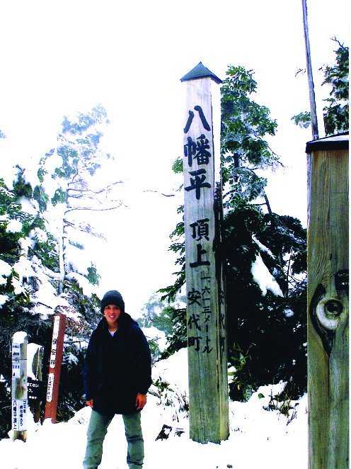
The trail was well marked and during the first hour I enjoyed a relaxing walk in the woods. It was late October, and I soon found the trailhead going from green to pure white. Two hours later, as I reached the summit, the trail was completely under snow and a beautiful white Hachimantai peak stood before me.
Trail Tips
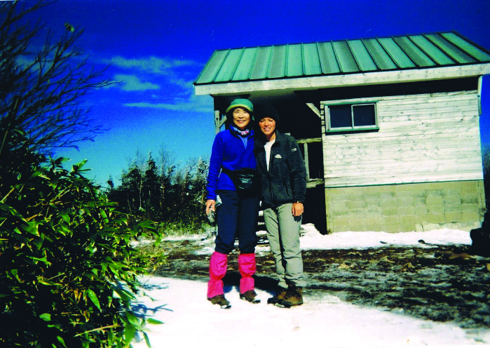
This trail is very easy-going as you already begin from stage one at 1,500 meters, so enjoying the scenery is essential. There will be many hikers in August-September. Starting at Mt. Chausu Trailhead is recommended, as buses frequent there and you can start the hike with a 360-degree view of the area. The Hachimantai swamp area is also gorgeous and worth carrying your good camera, as the trail is pretty smooth.
MOUNTAIN STATS
Mountain: Hachimantai
Difficulty Level: 1 out of 5
Location: Iwate Prefecture
Peak: 1,613 meters
Duration: Day hike. 4 hours, 10 mins.
When to go: Mid-June to early October
How to get there: From Tokyo Station take the Tohoku Shinkansen to Morioka Station, then take a bus to Mt. Chausu Trailhead. (茶臼口).
Getting There
Tokyo (2 hrs. 20 mins. ¥14,040) Morioka (1 hr. 35 mins. ¥1,200) Mt. Chausu Trailhead
What to Bring
- Raingear
- Flashlight
- Map
- Camera
- Sunscreen
- Water
- Camera
- Gloves
- Sunglasses
- Warm hat
- Food supplies
Contact Information
Morioka Kento-to Taxi: (019) 636-3335
Tourist Information: (0195) 74-2111
Things Not to Miss
When you finish the hike, you can enjoy the choice of two onsen located at the end of the trail near the Hachimantai ski area. Also, less than a half-hour drive from Morioka Station is the famous Koiwai Dairy Farm. Tourists can learn about farm production and taste various products made on the farm.
Koiwai Farm: (0196) 92-4321
Web: www.koiwai.co.jp/english/
