


After a great 10-hour sleep in the empty hut on Taka-dake, my internal clock woke me at 4:30 a.m. as usual. The caretaker of the place was a grumpy, yoga-obsessed old man who had told me my Japanese would be good if I stopped using that young slang, but as it was, my Japanese sucked. Very inspiring he was, but he did let me dry out my wet gear using the gas stove and even managed a smile when I departed that morning.
It was Day 6 of my solo trek through the South Alps. As it rained continuously the entire time on the trail, I had grown quite accustomed to wet boots and soaked raingear. Gusts kept visibility low throughout the morning.
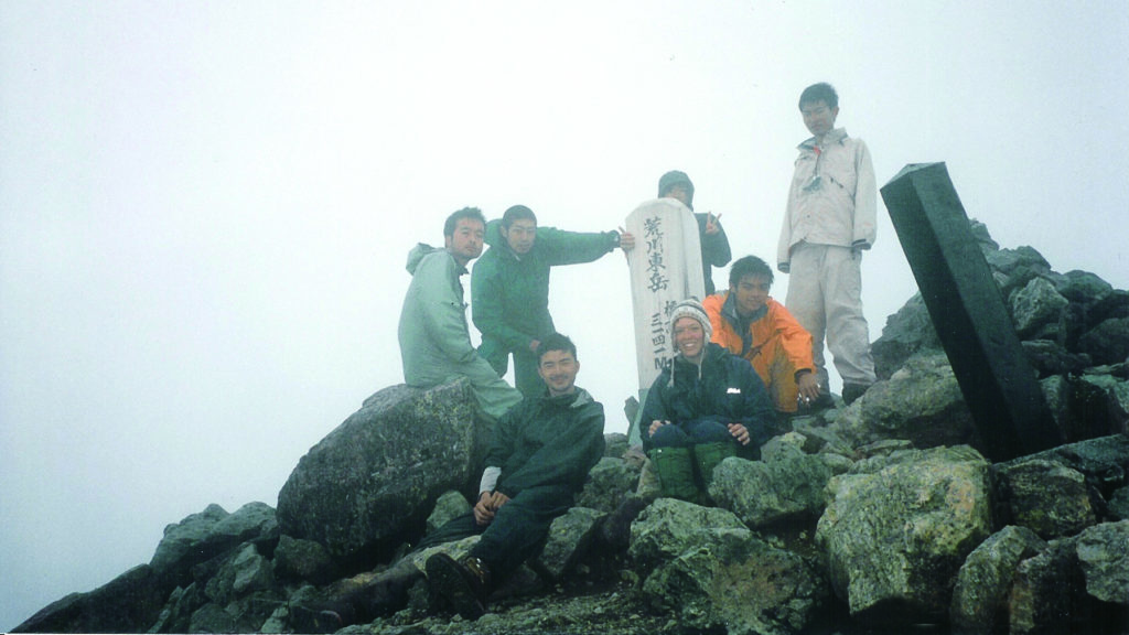
Along the way, I ran into a group of guys from the Waseda University Hiking Club. They were laughing and genki, so I figured they hadn’t suffered too long but, to my surprise, they had been out in the mountains for about a week. Sharing snacks and joking about the great weather, we headed up toward Akaishi-dake.
We stopped in our tracks as the clouds suddenly cleared and the sun was bright and fierce. We were like a crazed band of cowboys, hooting and hollering and saying how we loved the South Alps. The guys joined in a chorus of the Waseda University theme song. That lasted for about three minutes, and then it clouded over and the rain came down…again.
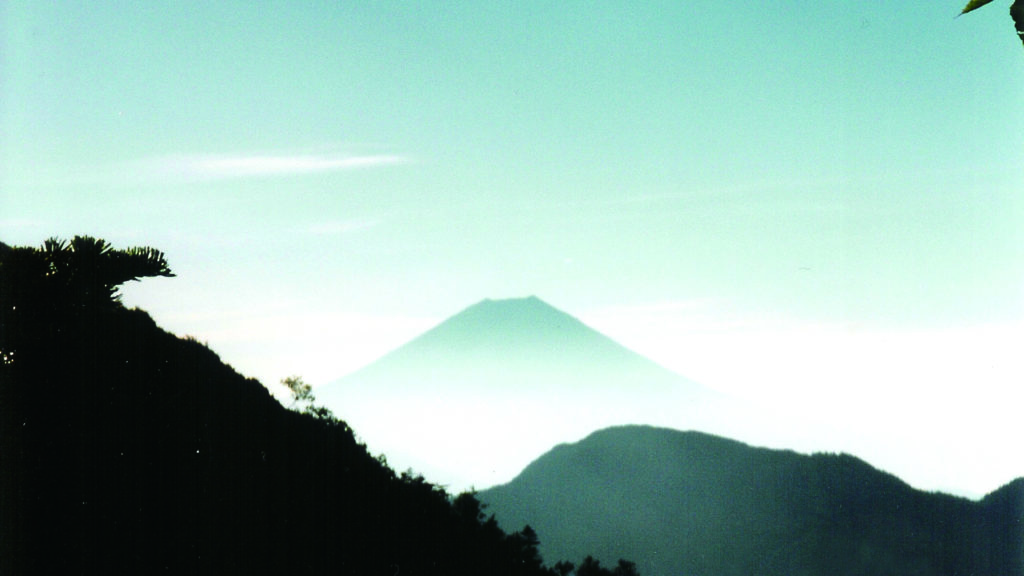
Coming out of Akaishi Lodge the next morning, I noticed the gray clouds did not look promising. It was Day 7, the last day of the journey, and deep down I hoped for a fine view of the mountains.
By mid-morning the clouds had lifted and, at 2,000 meters, blue sky and green-covered mountains emerged. By 10 a.m., Fuji-san was standing proudly in front of me, clear and bold along with the South Alps now behind me. I sat down and savored the view I had been yearning for this entire week.
Trail Tips: The huts in the South Alps are generally open year-round, but food is not available during non-peak season (July-August). The huts are often crowded in the summer, so it is advisable to bring your own tent or make a reservation in advance. Also, water is often far from the lodges, and you may want to carry a three-to-five-liter water container so you will have plenty on the trail. Even in summer, the night temperature can fall below zero, so be prepared for the worst and bring lightweight wicking layers that dry easily but stay warm.
MOUNTAIN STATS
- Mountain: Akaishi-dake
- Difficulty Level: 3 out of 5
- Location: Akaishi-dake lies on the border of Nagano and Shizuoka and is part of the Akaishi Mountains spreading over three prefectures.
- Peak: 3,120 meters
- Duration: 3-day hike, depending on route
- When to go: July to September
- Getting There: From Tokyo, take a Shinkansen to Shizuoka. From there, take a bus to Hatanagi Dam. Another bus will take you to the Sawara-shima Trailhead.
(1 hr., 25 mins., 6,380) (3 hrs., 35 mins., 2,550) (1 hr., 750varies) - What to bring: Raingear, flashlight, map, camera, sunscreen, water, camera, gloves, sunglasses, warm hat, food supplies.
Contact Information
- Shizuoka Chuo Taxi: (0542) 85-2191
- Shizuoka Tourism: (0542) 54-2111
- Tokai Forest Service Center: (0547) 46-4717
- Sanpuku-toge Lodge: (0265) 39-2303
- Takayamamura Lodge: (0547) 46-4717
Recommended Hiking Schedule
Day 1: 6 hrs., 45 mins.
Day 2: 11 hrs.
Day 3: 3 hrs., 35 mins.

 The guide to travel, the outdoors and active lifestyles in Japan. Enjoy activity guides, travel guides, hot spring guides, live weather forecasts, outdoor operators, places to stay, skiing and snowboarding, festivals and events and much more. Outdoor Japan Magazine. Japan's only bilingual magazine about travel, outdoors and lifestyle. Be part of the outdoor community in Japan.)