
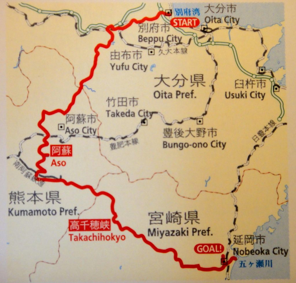
Japan’s northernmost island of Hokkaido is famous for amazing views, yet far south, the Aso area rivals its magnificence. From the vast grass fields of Kuju and Aso to the deep gorge in Takachiho, this route tours Oita, Kumamoto and Miyazaki prefectures and explores natural wonders and mythical places in eastern Kyushu.
Leaving behind numerous volcanic steam vents and a relaxing hot spring bath or two in Beppu, you are soon greeted with an 800-meter climb from sea level to Mizuwake Pass, before descending to the charming spa town of Yufuin.
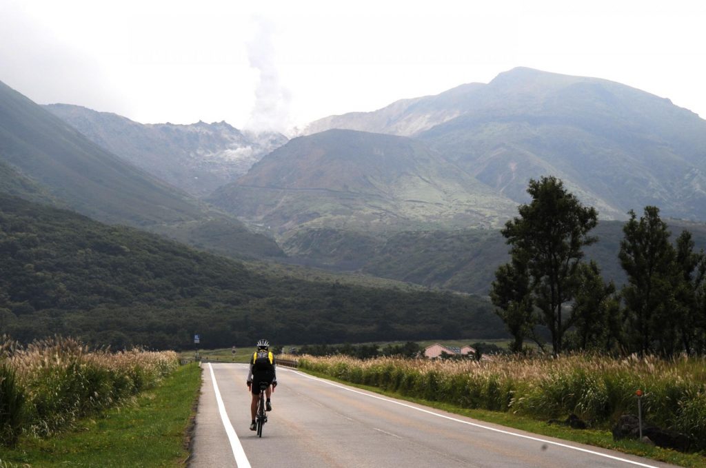
Against the backdrop of the Kuju Mountains overlapping each other, keep cranking on the Yamanami Highway that winds through meadowlands and over Makinoto Pass, the highest point on the route, to Daikanho. This peak is one of the somma (new caldera) ridges of the Aso Caldera.
The volcano has been active for approximately 300,000 years, and the upper part of the mountain collapsed after several large volcanic eruptions emptied its inside, forming the huge depression surrounded by these somma ridges that fill the caldera.
In fact, Mount Aso is the collective name for these mountains in the area. The caldera, one of the largest in the world, contains Mt. Naka and other central cones, as well as fields and towns surrounding them and the railroad which runs through the basin. Aso is one of the few places where people live in the caldera, or on the active volcano.

The central cone group divides the caldera into meadowlands in the north and plough lands abundant with springs in the south. Pedaling across the caldera, you get to see a dramatic change in the scenery.
Go over the somma again, through a tunnel under Takamori Pass, onto the ridge and a mostly downward-sloping road leads to Takachiho, where many ancient myths about the country’s origin lie deep in a gorge. One myth tells how Amatarasu, the highest deity ruling the Higher Celestial Plain, sent down her grandsonNinigi-no-Mikoto to earth on Takachiho to pacify the war-ravaged country.
In contrast to the expansive fields in Aso, a narrow gorge almost 100 meters deep stretches along the Gokase River for 20 kilometers. As you go downstream, the V-shaped valley gradually opens toward Nobeoka before meeting the Hyuga-nada Sea and the end of the trip.
-Translated by Sakae Sugahara