
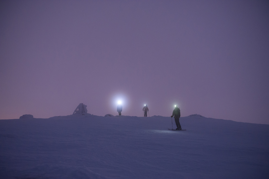
It was almost midnight when we set out on skins from the tiny collection of lodges at Guthega, a “ski village” in Kosciuszko National Park. It was late winter, and the forecast showed a large storm rolling in. Teddy Laycock, our basecamp manager, and I had been hauling in gear on pulks (Nordic toboggans) for two days.

With the storm fast approaching, we had to get back and make sure the tents lasted the night on the flanks of 2,196-meter Mt. Twynam, about seven kilometers past the trailhead. The storm was whipping horizontal sheets of rain and ice against us.

We found the trailhead and crossed the first creek without incident but, as we dragged our kits along a steep traverse, the going got tough. We slipped constantly on the snow-slop that was sliding off the ice sheet below. Looking ahead, we wondered how difficult it would be to find our cluster of tents.
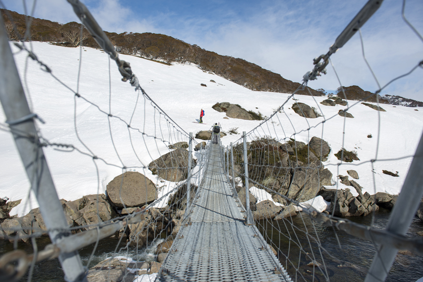
The blizzard, coupled with a thick fog, forced us to navigate entirely by GPS. We pressed on through the darkness, slogging toward each waypoint. Eventually, we reached Illawong Lodge, one of the Alps’ historic huts, where we crossed a suspension bridge over the Snowy River. We were on the home straight now, but we had a steep climb ahead.

As we gained altitude, the wind amplified. Icy water seeped down our necks and into our boots, soaking our base layers and socks. We finally spotted the tents nestled in a small grove of snow gums. They were rolling like fishing boats in the sea, the wind stretching the tent shells against distressed poles.
We got to work anchoring the tents with extra guide ropes and building snow walls to protect the camp from the wind. The storm, which we later discovered was the worst of the season, blasted on, stripping us of enthusiasm for our upcoming adventure. These were not ideal conditions, but not atypical this time of year either. It is why few choose to spend a month camping in the Roof of Australia in winter.
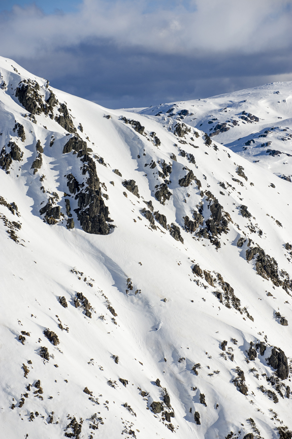
Eleven national parks and nature reserves make up the Australian Alps, home to the mainland’s highest peaks and covering 16,000 sq. km., an area larger than the Swiss Alps. This is the highest part of the Great Dividing Range and the only place on mainland Australia where deep snow falls annually.
The Alps stand out from a mostly flat Australian landscape. High-altitude peaks and undulating plateaus give way to deep glacier-carved valleys and glacial lakes. The area holds enormous ecological importance, home to diverse cold-climate plants and animals, many of which evolved in isolation and are found nowhere else on the planet.

Yet, it was the cultural history of the area that caught my imagination, and this is where skiing in Australia began. The Alps have a long history of indigenous occupation. People speaking at least 13 distinct languages visited the Australian highlands for festivals, ceremonies and trade – particularly in spring, when Bogong moths, which seasonally migrate en masse to the region, were harvested.
Following European settlement, explorers and prospectors flocked to the Alps in search of fortune. The highlands were summer grazing lands for cattle and sheep from the 1830s onward, gold mining towns were established in the 1850s and logging became prominent from the 1860s.
With industry came recreation. The Kiandra Snow Shoe Club, the world’s first alpine ski club, was established – not in Europe or North America – but in Kiandra, a now- abandoned gold-mining town in Kosciuszko National Park, in 1861. The birthplace of skiing in Australia was about 100 km. north of our camp.
Norwegian miners arrived in the 1850s and introduced the small alpine settlement to the sport, fashioning rudimentary skis out of flat planks of wood. These original skis were said to be repurposed fence palings. Skiing became so popular that, by the end of their first winter, there were no fences left in Kiandra, so the story goes.
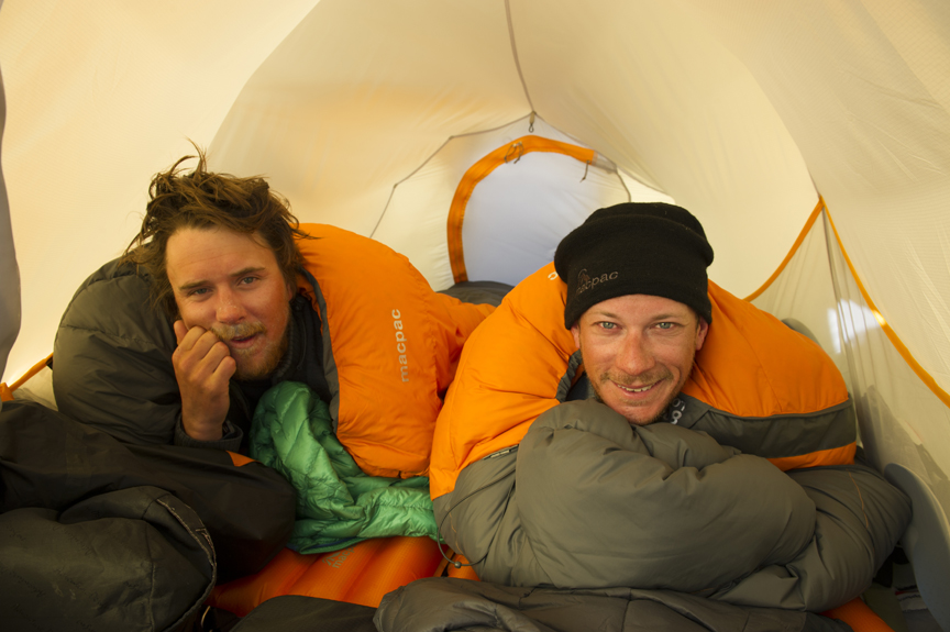
Our month-long camping, hiking and ski touring expedition through Australia’s alpine country would follow the tracks of these alpine pioneers. Our team included expedition leader Chris Booth, Teddy, myself and long-time local skiers Kenny Heatley, Tim Myers and Jake McBride. During the expedition a number of pro skiers, boarders and filmmakers joined us, drawn by the prospect of exploring Australia’s least accessible backcountry.
We divided the expedition into two stages. During Stage 1 we spent two weeks launching full-day exploratory tours through the northwestern reaches of the Snowy Mountains main range. We’d follow many of the original routes laid down by cattle drovers during those 19th-century summers. We wanted to feel the isolation and awe early backcountry skiers must have experienced as they traversed little known passes, as well as carve some new tracks of our own.
Part of the inspiration came from stories about the people who helped popularize skiing in the Alps in the 1950s. One such man was Colin Myers, a passionate skier and backcountry explorer who happened to be the grandfather of Kenny and Tim. Before there were any commercial ski fields in New South Wales, Colin would put on his leather ski boots and kangaroo skin vests for warmth and explore the mountains surrounding Kiandra on skis, occasionally venturing further afield to the Victorian Alps.

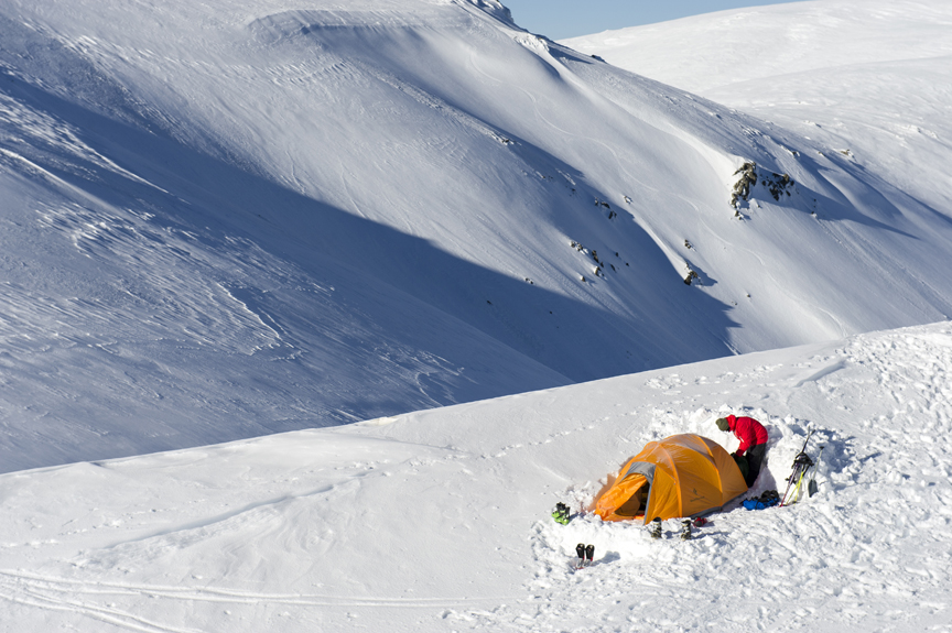
A true alpine pioneer, Colin eventually founded Selwyn Snowfields, a ski resort still in operation today. However, he is more famous for one of his earlier entrepreneurial endeavors. Hoping to attract more people to his beloved sport, Colin used a six-cylinder Dodge engine and a gearbox from a Matilda Tank to construct one of Australia’s first rope tows on the old King Cross Road near Kiandra in 1956. The “tank tow” was a catalyst for the skiing boom that lasted several decades. Sixty years later, outside the ski resorts, these mountains remain largely uncharted in winter and little is published of the Australian backcountry. From our base camp at the Arc of Trees and a second camp pitched higher in the range, we explored Caruthers Peak, the Sentinel, Watsons Ridge and the Crags.
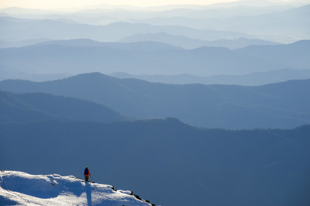
The terrain was steep, with 400 meters of vertical in places. Long, white slopes separated vistas filled with rugged spurs. Enormous ice walls and jagged cliff faces descended to rocky valley floors, while forest-clad hills rose to icy ridgelines.
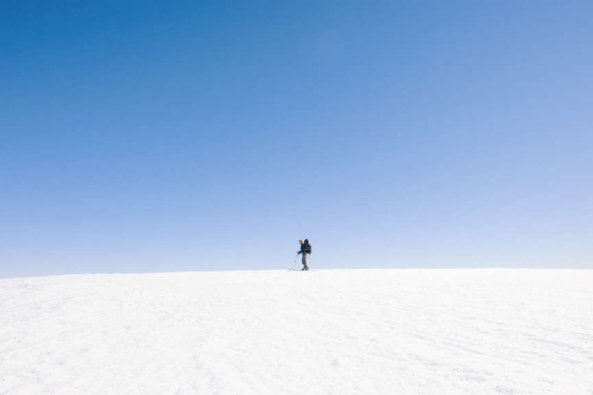
Aside from the initial storm, our expedition was blessed with mostly clear skies. We hiked and skied this northern approach for nearly three weeks. The farther we ventured, the higher the probability we were making first descents in this massive terrain. We were sunburned, half frozen and exhausted but in awe of the exceptional landscape.
During the 1970s and ’80s, backcountry skiing grew in popularity in Australia. Many of the old drovers’ huts, dotted across the Alps, were converted into makeshift lodges for skiers. Today, many have been decommissioned or destroyed by fire, but those that remain are primarily maintained as emergency shelters for skiers and hikers. In the Kosciuszko area, about 90 huts still exist.
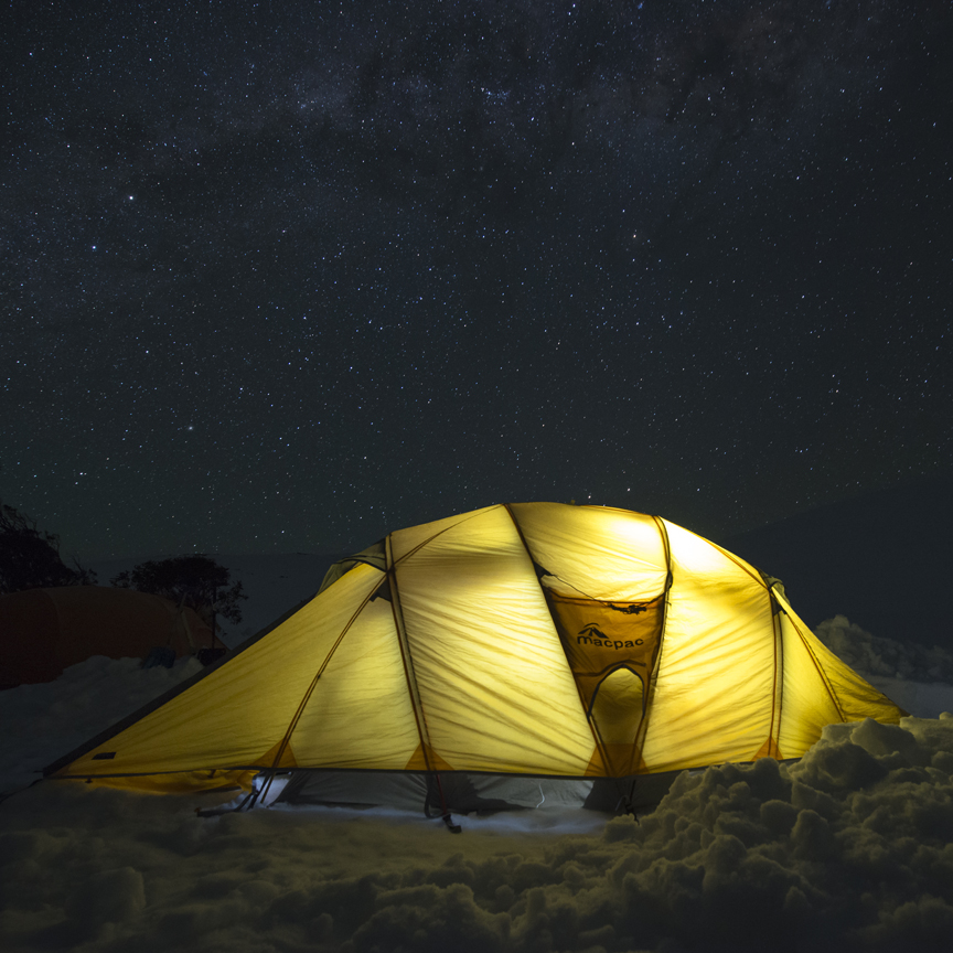
During Stage 2 of the expedition, we traversed the southern end of the main range, moving camp daily until we reached Seaman’s Hut. The sturdy granite hut is a refuge for hikers and skiers and sits near the top of 2,228-meter Mt. Kosciuszko, the highest peak on the Australian mainland. It was built in 1929 in memory of Laurie Seaman and Evan Hayes, two skiers who died of exposure during a blizzard in the area a year earlier.
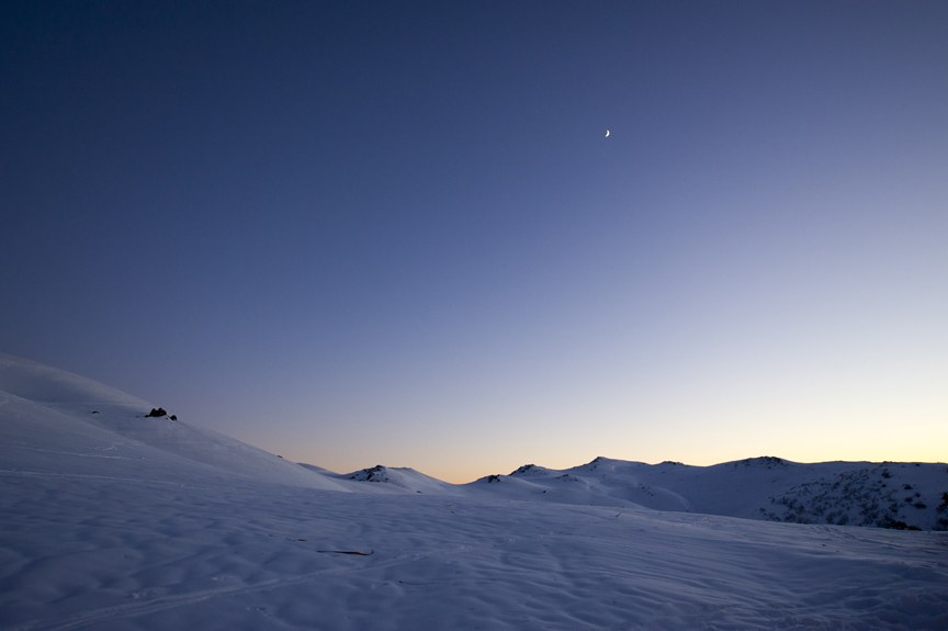
We pitched camp next to the hut. Once darkness fell, the night sky rotated slowly, carrying the Milky Way with it above our tents, a billion stars reflecting across the desolate expanse. With the exception of the hut, there were no traces of human existence. I couldn’t help but reflect on the handful of drovers, goldminers, loggers and skiers who looked out at the same white, folding hills and sharp, silhouetted peaks. From here, we would push on to Mt. Townsend (2,209 meters), the second-highest peak on the Australian mainland.

The following day was the most challenging of our expedition. Physically and mentally exhausted from weeks of skiing, hiking and sleeping on the snow, we were faced with a long traverse along a jagged, icy face between the two highest peaks in the Alps. Howling winds coated the ridge in razor-like ice shards, yet crossing it was the only way to reach our new exploration zone.
Two members of our team fell on the traverse and were quickly shredded by sharp ice. Heading deep into the western faces, we saw this as an all-too-timely reminder this was not an area where we would expect to find help quickly or easily. Using ice axes and crampons, we carefully picked our way along for several hours into a howling icy wind blowing in from the southwest.
We reached the saddle of Mt. Townsend at about mid- day. Our wind-whipped faces were bitterly exposed to the sun, which had a powerful sting. We searched the rocky outcrops for a suitable campsite and discovered a sheltered grove of rock and snow in the crown of Mt. Townsend. We pitched camp at 2,158 meters. Standing on one of the highest points of the Australian mainland, we could see the rolling ridges of the lower Alps stretched for kilometers all around us.
We were close to the western-most reaches of the snowline, and we could see vast expanses of ski terrain, a paradise of boulder-scattered slopes, cliffs and ridges just waiting to be explored. We camped here for four days, hiking and skiing the highest peaks and longest runs on the Australian mainland. This is why we came to the Roof of Australia.