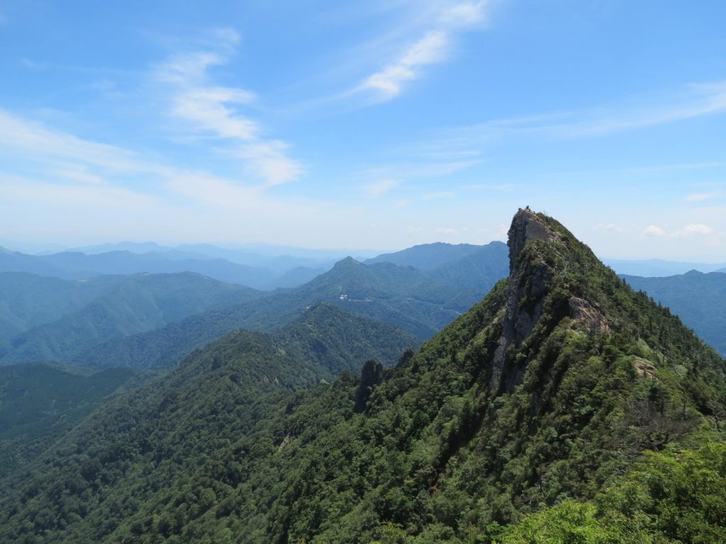
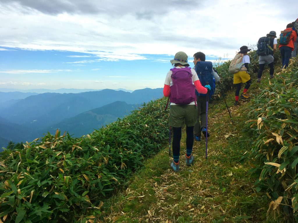
The mountains of Shikoku Island are a place of spirituality and vast wilderness. The Ishizuchi Mountains extend about 60 kilometers from east to west in western Shikoku, bordering Ehime and Kochi prefectures. The 1,982-meter Mt. Ishizuchi is the tallest mountain in western Japan and its four shrines are sacred points for outdoor enthusiasts seeking a spiritual experience.
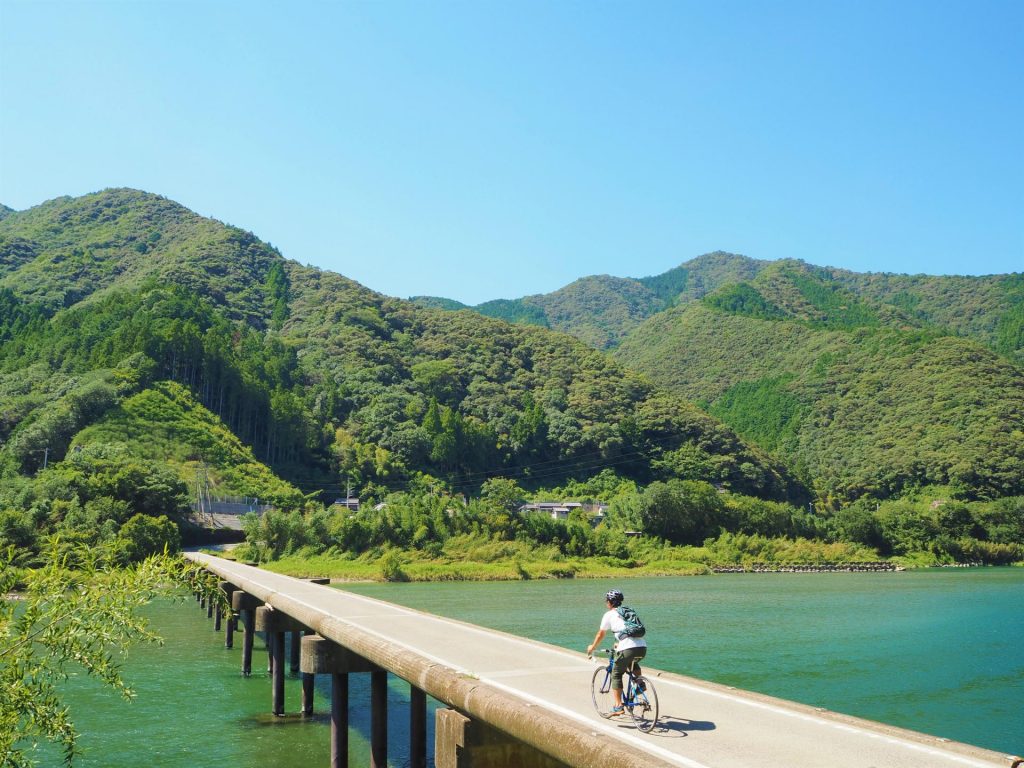
The steep terrain makes for a challenging but rewarding ride for fit cyclists. Public transportation is limited here, so the best way to fully immerse yourself into Shikoku culture is by cycling the Japan Eco Track. Access from Tokyo or Osaka is easiest by flying to Matsuyama Airport in Ehime (1.5 hours from Tokyo and 50 minutes from Osaka). Take a bus to Matsuyama Station (25 minutes) then take an hour-long train to Iyo-Saijo Station or drive 45 minutes from Matsuyama IC to the Ishizuchi region.
Scenic Sky Ride Route
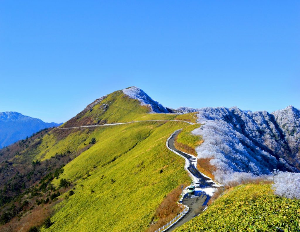
This 156.4 kilometer route starts and ends at Michi no Eki Konoka, a roadside station with an open-air onsen. It takes approximately 12.5 hours to circumnavigate this route. The first four-and-a-half hours involve some serious uphill pedaling along the UFO Line which follows the ridgeline.
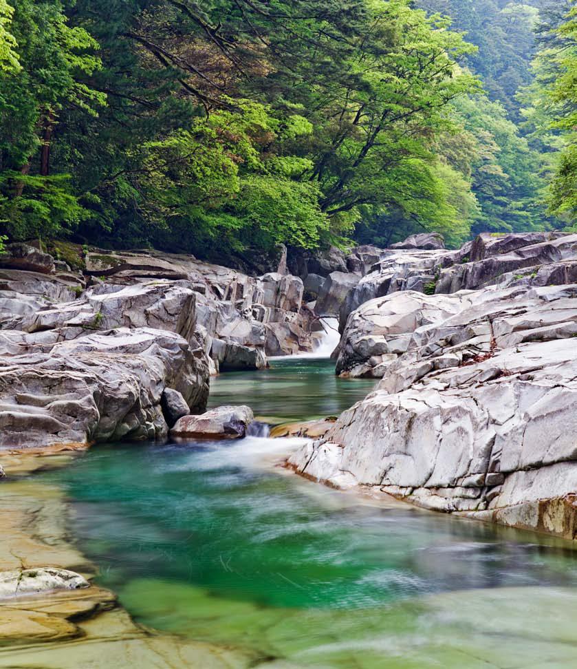
From here you can see the jagged peak of Mt. Ishizuchi and even the Pacific Ocean on clear days. After taking in the bird’s eye views, enjoy a leisurely ride down following the flow of Omogo River which flows down Mt. Ishizuchi and becomes Niyodo River as it enters Ehime. Refresh yourself at Kinen Waterfall and rest at Fureai no Sato Yanagino, a store selling local products. Located against a rural backdrop, this quaint store serves udon and soba milled by a waterwheel-powered mill. Brace yourself for a final uphill stretch to Michi no Eki Konoka, or make your way to Sameura Dam.
Sameura Dam Mountain Route
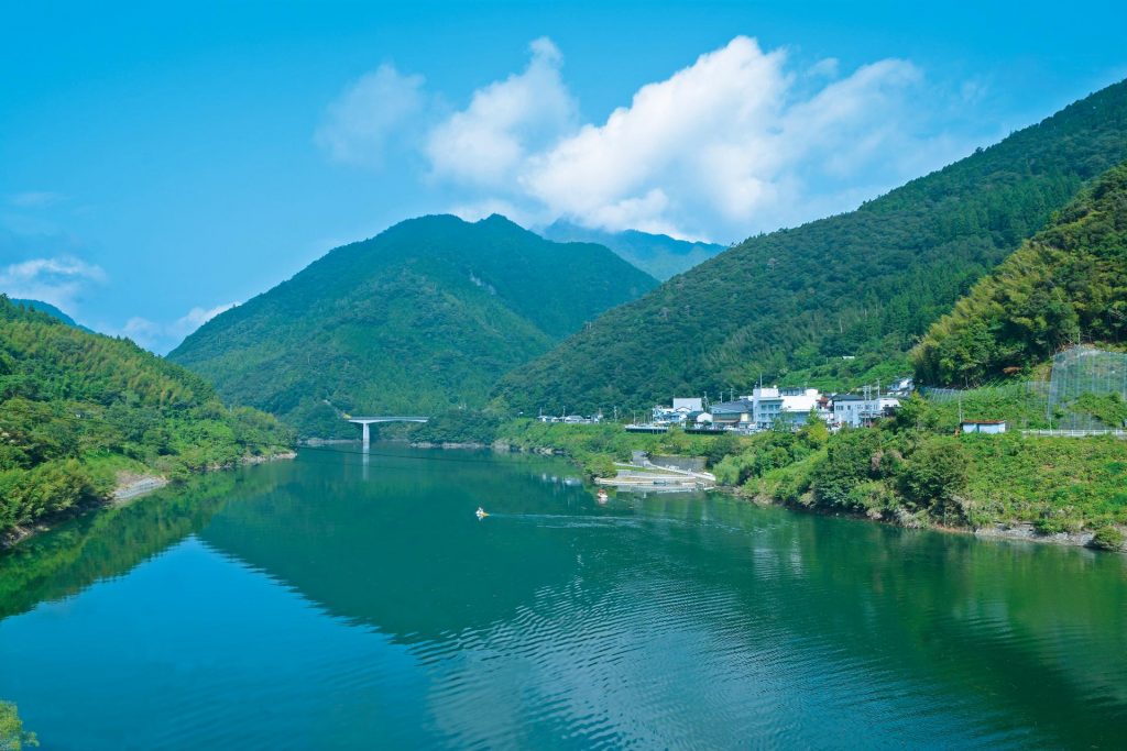
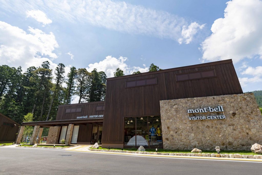
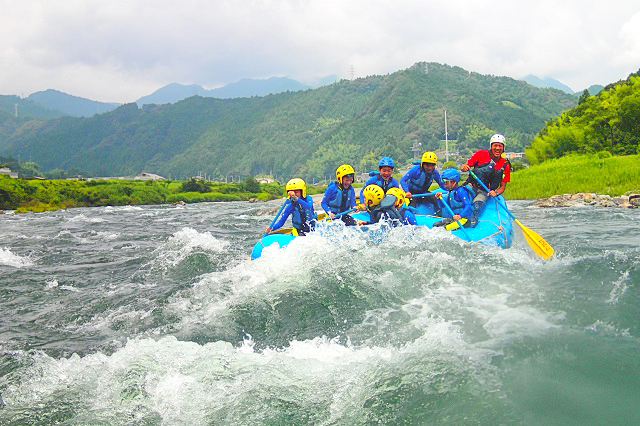
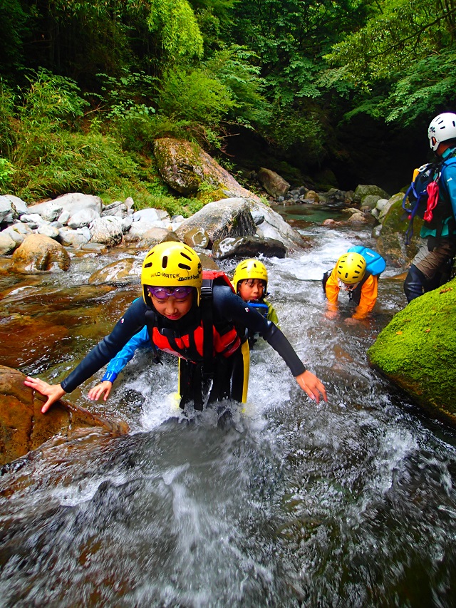
While the Scenic Sky Ride Route features the best of Shikoku’s mountains, this intermediate route is centered around water, specifically Sameura Dam. This dam is the source of the clear Yoshino River, considered one of Japan’s three great rivers. It takes a little less than seven hours to circumnavigate this hilly route which passes through traditional forest villages and the two-tiered Kogane Falls, the tallest waterfall in Shikoku. Alternatively you could start from Montbell Outdoor Village Motoyama located near the dam which features comfortable cottages, restaurants and hot bath facilities. If you’re wanting to try other outdoor activities, inquire about canyoning, a popular activity at Omogokei Gorge. There are also riverside barbeque and camping spots.
About Japan Eco Track
Montbell—Japan’s largest homegrown outdoor brand—started a series of events in 2009 called Sea to Summit. The goal was to invigorate local areas, holding events to experience nature through canoeing, cycling, trekking and other means of human-powered movement. While these events continue to be held in beautiful areas around Japan, the natural progression was to provide information and guides so travelers could experience these areas throughout the year at their own pace while learning the history and culture of the region and interacting with locals.
Japan Eco Track guides contain maps with designated routes of varying difficulty levels. Each guide includes information on local restaurants, guides, tour operations and other attractions. Along Japan Eco Track routes there are support stations located at affiliated stores and major transportation hubs such as train stations, airports and Michi no Eki (rest areas). Discounts and special offers are available at participating locations when travelers show the Japan Eco Track booklet. There are more than 15 guides, with new areas being developed and offered in English.
For more information, visit www.japanecotrack.net.