
Trail runners yearn for breathtaking, sigh-inducing views. The Tanzawa trail running course is a famous hiking course located in the Higashi Tanzawa (Eastern Tanzawa) area. It’s a full-day course with chains, ropes and steep descents and recommended for the seasoned runner. Although the climb is long, the reward when you reach the top makes it well worth the effort.

Details: The Tanzawa mountain range is located just west of Yokohama and southeast of Mt. Fuji. It is a popular hiking area known for its steep mountains and fantastic views. One of the most famous trails here is what is referred to as “Omoteone” (表尾根), a long mountain top ridge route running west from Yabitsu Tōge to Tōnodake. While some of the sections here are very technical with chains and ropes along the steep and rocky trail, other sections provide some exciting trail running.
To reach the trailhead, catch a bus from Hadano Station. They run infrequently, so be sure to check the schedule. The bus slowly winds up the mountain and lets you off at the final stop, Yabitsu Tōge. There’s parking here for those planning to do an out-and-back run. From Yabitsu Tōge, jog along the paved road for about a kilometer until you reach Fujimisansō (富士見山荘). This is where you’ll start your ascent. There’s a tea house (although usually closed on weekdays) and a washroom here.
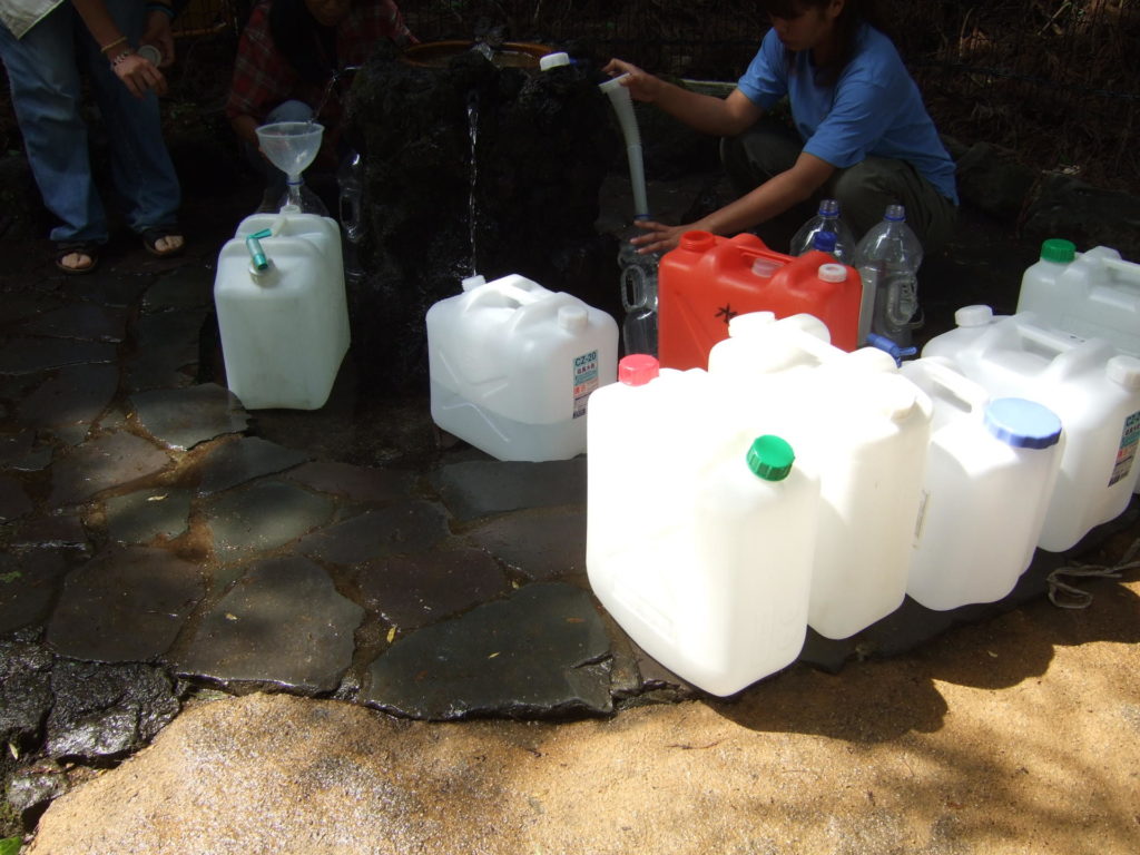
If you need water, walk down the road another hundred meters to the Gomayashiki no Mizuba (護摩屋敷の水場). In the old days, monks used to bless themselves with this sacred water. Nowadays you’ll find plastic bottle toting (ポリタンク)commoners gathering at this famous water spot to fill up.
The trails are well marked to your mountaintop destination, Tōnodake. However, in order to reach this peak, you will have to make it over several smaller peaks. Walk up the paved forest road for a few hundred meters to reach the trailhead. From here, it’s a rather long climb up a forested trail.
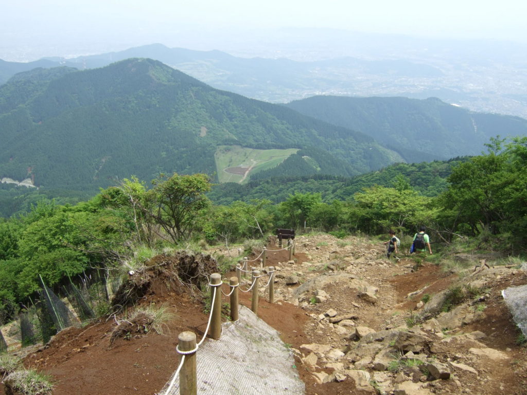
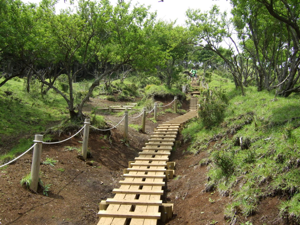
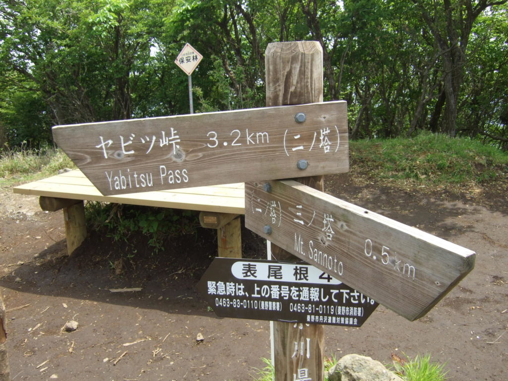
You’ll pop out onto a paved road, turn left on the road and re-enter the trail from the trailhead located a few meters away. The first big peak is Ninotō (二ノ塔). There are a few picnic tables where you can rest but, if you have the energy, keep going to the next peak, Sannotō (三ノ塔), just another 10 minutes away.
This is where the real views begin. Oyama to the east and the Hakone and Izu mountain ranges and Mt. Fuji to the west provide stunning views. The descent toward the next checkpoint, Karasuoyama(烏尾山), is steep and rocky. Tread carefully and use the ropes. Next, you’ll pass Gyōshagadake (行者ケ岳), Shindainichi (新大日) and several mountain huts along the way. Up and down, across skinny ridges, the trail running up here is outstanding.
One last climb will take you to the course’s highlight, Tōnodake (塔ノ岳). At 1,491 meters above sea level, this peak offers dramatic 360-degree vistas that will remind you why you love trail running so much. It should take you three or four hours get here. There’s a mountain hut called Sonbutsu Sansō (尊仏山荘) here where you can buy drinks and food (albeit expensive) and a washroom.
Rest up for the long descent or, if you have enough energy and time, a quick out-and-back run to Tanzawa-san (丹沢山) is highly recommended. Located smack dab in the middle of the Tanzawa mountain range, Tanzawa-san is one of Japan’s sacred “hyakumeizan” (100 famous mountains), and the trail is utterly breathtaking.
From Tōnodake, prepare your quads and knees. It is pretty much downhill all the way. In fact, it’s a 1,200-meter elevation loss. The route, called Okuraone(大倉尾根), is a ridge that runs north-south and is often referred to as “bakaone” or “stupid ridge” (バカ尾根), a name most likely earned because the trail is ridiculously long and steep. Make your way down a very long set of stairs, run down the rocky trail and continue down the dirt path.
Along the way, you’ll pass Kinhiyashi (金冷シ), several mountain huts (Hanatate Sansō, Horiyama no Ie) (花立山荘,堀山の家) and teahouses (although some of the older, weathered-looking teahouses appear to be permanently closed).
At the end of the trail, you’ll reach a paved road. Follow it to Okura (大倉) where you’ll find the Hadano Visitor Center (秦野ビジターセンター), washrooms, several small shops and restaurants as well as the bus stop where you can catch the bus to Shibusawa Station.
Getting There & Getting Back アクセス
Getting to the trailhead: From Shinjuku, take the Odakyu Line to Hadano Station (approximately 70 minutes). From here, it is a 48-minute ride up to Yabitsu Tōge(ヤビツ峠) on bus #21 「秦21」. Buses only run a few times a day, so be sure to check the bus schedule when planning your hike.
Getting back: Take the bus from Okura bus stop to Shibusawa Station on the Odakyu Line (approximately 15 minutes).
Useful Info
MAPS
Hiking Map / ハイキング地図:
“Yama-to-Kogen,” Map #28: Tanzawa / 山と高原地図28 「丹沢」
1:25,000 Topographic Map / 地形図: Hadano, Oyama / 秦野、大山
Web Connection
Kanachu Bus / 神奈川中央交通: www.kanachu.co.jp
Hadano Tourism / 秦野市観光協会 : www.kankou-hadano.org
Hot Springs
Yukaraku湯花楽: www.yukaraku.com
Take Bus #18 from Shibusawa Station (North Exit) for eight minutes to Shiroyamatsuka Bus Stop.
渋沢駅北口から「秦18」のバスで8分、白山塚バス停よりすぐ。
Course Info
Course Name: Higashi Tanzawa Omoteone
Route: Yabitsutoge to Omoteone to Tōnodake to Okura. ヤビツ峠〜富士見山荘〜二ノ塔〜三ノ塔〜烏尾山〜行者ケ岳〜新大日〜塔ノ岳〜金冷
シ〜堀山ノ家〜大倉.
Distance: 14.5 kilometers
Time: Hike 6 hours, 15 minutes / Run 3.5 – 5.5 hours
Season: April – November