
Hiking the entire one thousand kilometers of the Michinoku Coastal Trail (MCT) can take about two months. Yet if you only have saved up a couple weeks of vacation time, don’t worry, some of the most adventurous, breathtaking spots aren’t too difficult to access. You can easily get your fill in just a few days—if you target the right sections. First, a bit of background about the creation of Japan’s newest long-distance nature trail.

After the Great East Japan Earthquake and Tsunami in 2011, the Japanese government funded a number of initiatives to rebuild the coastal areas while promoting sustainability. In 2013, several parks were merged to create the Sanriku Fukko National Park. It spans 28,537 hectares (110.18 square miles) along Japan’s northeastern coast. A trail was planned that would start at the northernmost point of the park in Hachinohe, Aomori, traverse the southern tip in Kesennuma, Miyagi, then continue all the way down to southern Fukushima.
The MCT officially opened in June 2019, but almost immediately suffered a severe setback when super typhoon Hagibis struck in October that same year, causing landslides and making several parts of the trail impassable. It was more than a year before all the damaged areas were completely repaired. Since then, there hasn’t been any problems, and I’ve been guiding hikes along it since Japan’s borders reopened in October 2022.

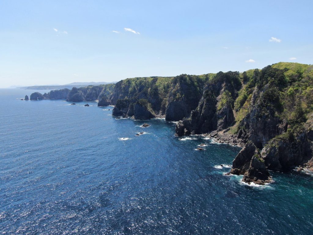
The northern part of the trail is wilder, running up and down rugged coastal cliffs, across hidden beaches connected by old hand-carved tunnels and through fishing villages before gradually giving way to civilization further south. The southern section of the trail allows hikers a more cultural and historical experience as they cross through Miyagi and Fukushima prefectures. If you only have a brief time to explore the trail—and stunning views are a priority—I highly recommend the northernmost section for a few days of hiking.
Start your adventure at the northern trailhead at Kabushima Shrine in Hachinohe. If you don’t have a car, take a local train from Hachinohe Station to Same Station then walk to the shrine. In addition to being a sacred shrine where locals pray for good luck for business and successful fishing trips, it’s the best place in Japan to see nesting black-tailed gulls. There are so many, in fact, the shrine lends out umbrellas at the entrance to protect against gull droppings. (Be aware that if one does happen to hit you, you can get a free wooden amulet with your name, stating you were “blessed” by the birds.)
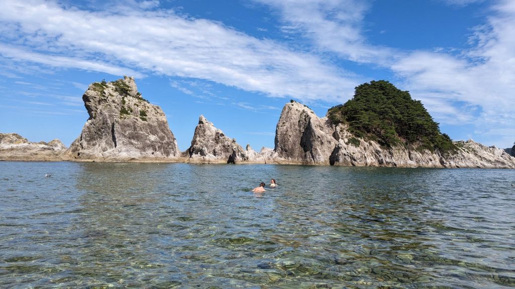
From Kabushima Shrine, walk south and you’ll get to Osuka Beach. The beach has been designated as one of Japan’s Top 100 Beaches (Japan loves a good top 100 list), and features “crying sand,” which makes a high-pitched noise when you walk across it barefoot. This is a great place to take off your shoes and let the waves lap over your ankles as you stroll—or better yet, stop for a swim.

Later you’ll reach the Tanesashi Coast, offering a gorgeous panoramic view of both the rocky coast and a beautiful natural grassy lawn where horses used to graze. The campsite here is fantastic, with barbecue areas, public restrooms, a fire pit and room for 250 tents (tent and blanket rentals are available). Stop here for the day or, if you’d rather hit a hotel, finish your first day with a casual, 10-kilometer walk at Okuki Station.
After this little warm up is the grand adventure. The most difficult section of the entire 1,000-kilometer trail are the glorious coastal cliffs of Tanohata. You could start this segment in the village of Fudai, which was spared from the 2011 tsunami by the impressive foresight of the mayor who, in the 1980s, built a 15.5-meter seawall, higher than was deemed necessary at the time. As a result, the town was mostly untouched by the tsunami while other fishing communities just to the south (but with lower seawalls) were devastated.
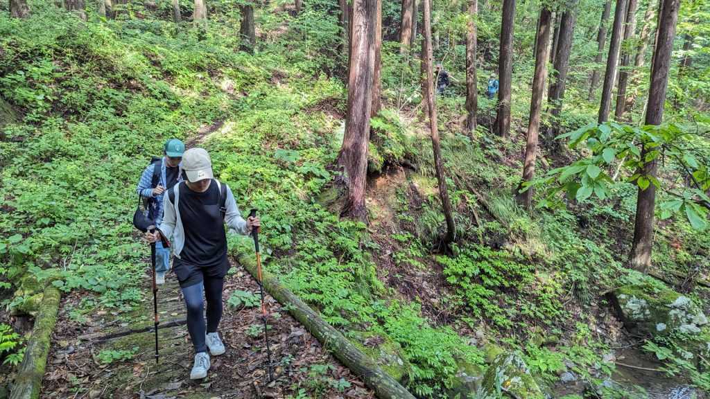
This section of the hike weaves through forests, across streams, up and down steep slopes and roughly made stairways to glorious viewpoints at the top of the cliffs and hidden beaches below towering rock formations. It is not for the light of heart or weak of knee. While you can break it down and pinpoint certain sections instead of attempting the entire (roughly 30-kilometers) hike, to reach many of the most impressive areas requires climbing and descending steep hills multiple times.
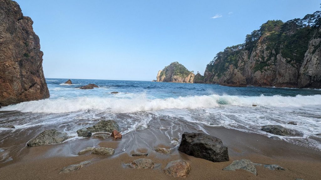
One of the highlights is an area with two long hand-carved tunnels, devoid of light and home to bats, that open onto a secluded beach that’s perfect for a lunch break or playing in the waves. A little past this area you’ll reach Aketo, where along with the ruins of a seawall destroyed in the 2011 tsunami, there is a beach, campsite and shower facilities for hikers. If a hotel is more your style, continue on to Hotel Ragaso just a short walk to the south, right on the coast.
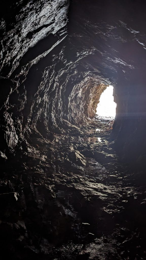
If you don’t have time or aren’t inclined to hike for an entire day, but like the sound of hand-carved tunnels and secluded beaches, then I recommend just heading for the Unosu Cliffs in Tanohata. From the parking lot you can take a very short (900 meters), but steep, hike down to a gravel beach and then north through another little tunnel into a hidden sand beach below towering 200-meter cliffs. There are four sections of tunnel here that provide access to secluded sections of the coast below the cliffs. You’re almost guaranteed to have them all to yourself, as the maps provided by the park service mark that area as impassable (because of sunken ground) and offer a detour along inland roads. During low tide you can usually go all the way across, but even when the tides are higher, it’s still worth seeing even if you have to go back the way you came. (Just be sure to approach it from the Unosu Cliffs and head north.)
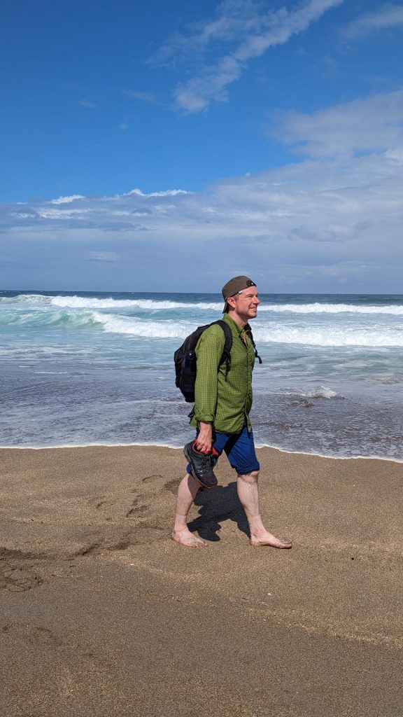
I highly recommend hiring a guide to take you along the Michinoku Coastal Trail. It is definitely possible to do it alone (especially the first section near Kabushima Shrine and Tanesashi), but with the more difficult or remote sections, you’ll have a much better time with a local guide leading the way. This area has a rich history, and learning about local flora and fauna, folklore and the events around the 2011 tsunami will deepen your appreciation of the area.
Web Connection
The Michinoku Trail website has some great details on the northernmost segment of the trail as well as the entire MCT.