Although I have been known to be an ame-onna, a woman whose presence seems to bring rain, this time around the gods were taking care of me. Not a cloud in sight, but the chill at nearly 3,000 meters had encouraged me to put on all my layers including rainwear.

Three days before, it had snowed in the Alps, and the raicho, what we southerners call the snow chicken (ptarmigan), were gearing up with their white coats. It was enough for me to forego my tent and spend my evenings eating home-cooked meals in cozy mountain huts along the way.
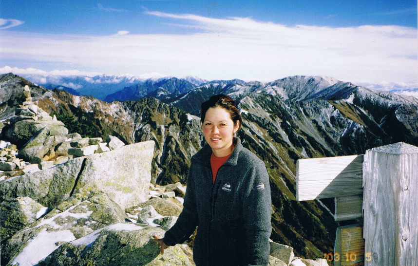
As I reached the top of Suisho-dake, the local name for what the map calls Kuro-dake, I let out a sigh of relief. I was near the end of my 12-day hike in the North Alps and I could see Kasaga-dake in the distance, the last peak I had planned on climbing in the area.
Trail Tips
A four-day hike can be physically demanding, so pay attention to your body’s needs and take breaks often. Lighten your pack load by staying in huts and taking meals there as well; you won’t have to bring as much gear and food.
The weather changes quickly in the mountains, so check the weather report posted in the hut or ask the staff for the latest information. Make sure you reserve a space in the hut in which you’re planning to stay at least a few days before your hike, as it gets unbelievably crowded in the summer months.
If you are not good with tight space, bring your tent but make sure you have an adequate rain fly and warm sleeping bag.
Hut stays are about ¥9,000 for one night stay and two meals; it is recommended to reserve ahead of time during the summer months.
MOUNTAIN STATS
Mountain: Washiba-dake and Kuro-dake
Difficulty Level: 5 out of 5
Location: Nagano, North Alps
Peak: 2,924 meters and 2,986 meters
Duration: Four-day hike
When to go: June – Late October
Things to Bring: Trail map, raingear, flashlight, map, camera, sunscreen, plenty of water, camera, gloves, sunglasses, warm hat, enough food to last five-to-six days, tent, rain fly, tarp, blanket, sleeping bag, extra batteries.
Getting There
From Shinjuku take the JR express train to Shinano-Omachi Station (信濃大町), and from there take a taxi to Takase Dam(高瀬ダム), the entrance to the trailhead.
Shinjuku ⇒ Shinano-Omachi Station ⇒ Takase Dam Trailhead
(3 hrs., 11 mins. ¥7,640) ⇒ (40 mins. ¥8,000)
Contact Information
Omachi Tourist Information: (0261) 22-0420
Matsumoto Railways: (0263) 35-7400
Matsumoto Bus Service: (0263) 92-2511
Sui-sho Hut (水晶小屋): (0263) 31-2662
Eboshi Hut(烏帽子小屋): (0263) 22-4293
Sugoruoku Hut(双六小屋): (0577) 34-6268
Things Not to Miss
Shin-Hotaka Onsen (新穂高温泉):Shin-Hotaka Onsen near Hotel Hotaka when exiting the trailhead offers nearly 50 quaint onsen pension and ryokan.
Recommended Hiking Schedule
Day 1: Hike 6 hrs, stay overnight at Eboshi Hut (烏帽子小屋)
Day 2: Hike 7 hrs, 30 mins, stay overnight at Sui-sho Hut (水晶小屋)
Day 3: Hike 5 hrs, 30 mins, stay overnight at Sugoruoku Hut(双六小屋)
Day 4: Hike 5 hrs, take local bus back to town