Whether you are traveling through Japan on a tight schedule or just need a quick escape from the city to clear your mind, there are plenty of options. Here are our top picks for the season.
Mt. Takao

One of the most convenient and family-friendly hikes, Mt. Takao has eight trails, six of which are designated as “nature study courses” ranging from easy to intermediate. There is a mid-point with a great beer garden, monkey park, shrines and food stalls you can reach via cable car or lift.
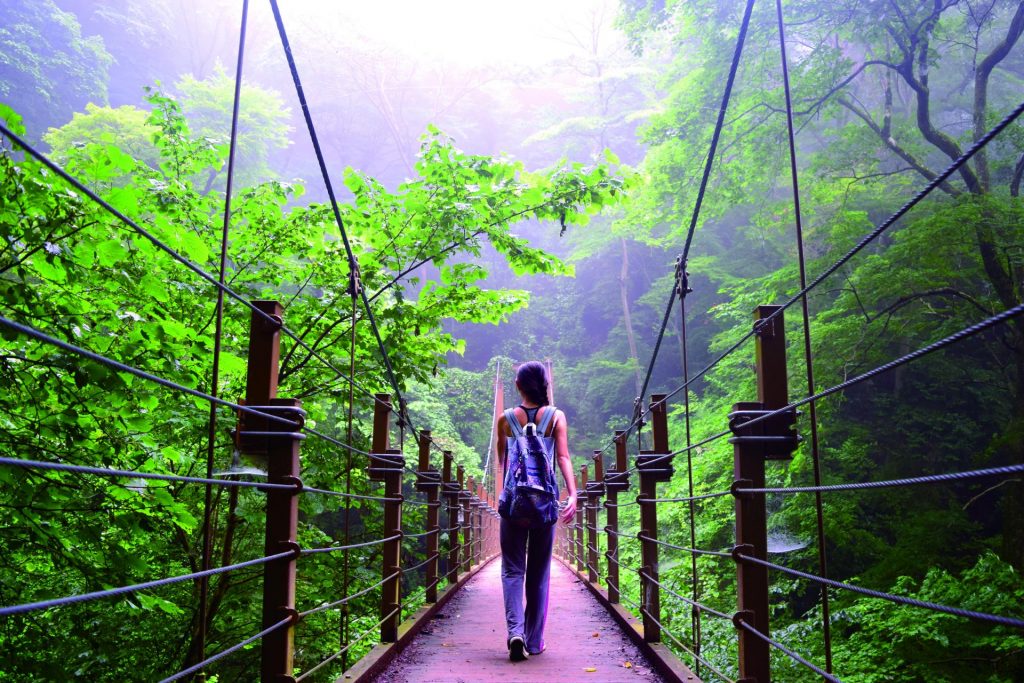
If you prefer to walk, take Route 1 up before continuing to Route 4 for a stroll over a suspension bridge. Route 6, which goes directly from the base of the mountain to the top, is a slippery path alongside a stream with small waterfalls including Biwa Falls along the way. Round trip takes about three or four hours.
From Mt. Takao’s peak, you can see Mt. Fuji and the Tanzawa Mountains to the south. Mt. Takao is part of the Mt. Jinba Trail, a five-hour hike passing by the peaks of Shiroyama and Kagenobuyama and ending at the 857-meter-high Mt. Jinba.
Getting There: Mt. Takao’s trailhead is a five-minute walk from Takaosanguchi Station on the Keio Takao Line. The fee for the cable car that goes up to the mid-point is ¥480 for adults and ¥240 for children.
Mt. Otake
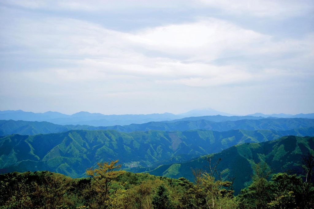
Located in Okutama, the western edge of Tokyo, Otake-san (1,267 meters) is one of Tokyo’s highest peaks. On a clear day especially before noon, you will be rewarded with a view of Mt. Fuji.
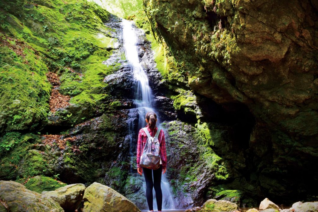
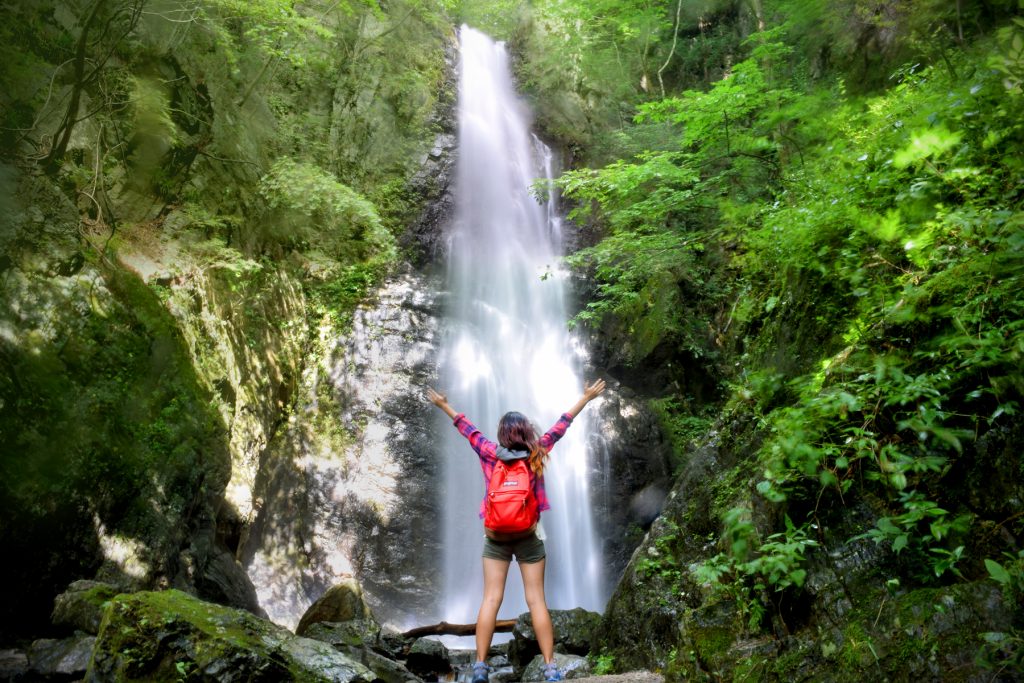
Must-sees on this hike are two waterfalls, Nanayo Falls and the bigger Ayahiro Falls, a famous “power spot” used for takigyo (traditional waterfall meditation). To get to these falls, you go through the Rock Garden, a narrow, forested valley noted for its moss-covered rocks. It takes around an hour from Mt. Mitake but is relatively easy and child-friendly.
Mt. Otake is another hour from the Rock Garden. The trail is not extreme, but be aware that the last stretch up is rocky and can be slippery. There is a shorter trail that leads you back to Mt. Mitake on a different route. Signs are written in English and Japanese.
Getting There: Take the train to Mitake Station on the JR Ome Line, then bus (10 minutes) or walk (30-40 minutes) to the Mitake-san Cable Car Station. From there, ride the cable car (¥545) or walk on a paved road up to Mt. Mitake ( 929 meters).
Hyakuhirono Falls
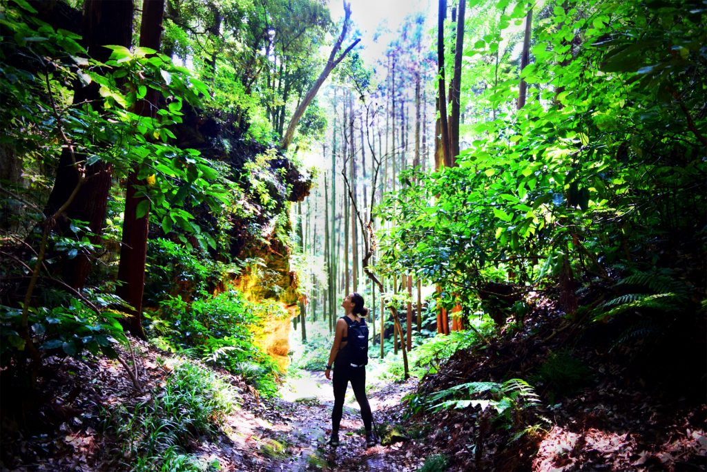
The 40-meter-high Hyakuhiro Falls deep in Okutama is an impressive sight. If you start just past Kawanori Bridge, it takes about two-and-a-half hours to reach the falls from the Mt. Kawanori trailhead.
The first half takes you up a paved road before descending into the valley. The beauty of this trail is the solitude. Unlike Mt. Mitake and Mt. Takao, there are no vending machines, shrines, rest stops and food stalls lining the streets. Follow the sign that says “Hyakuhiro-no-taki” in Japanese (百尋ノ滝).
Be sure to wear proper hiking shoes as the latter half, especially the last half-hour, can be slippery. The icy waterfall is usually quiet except for the white-spotted char swimming in the streams and pools.
From the falls, you can continue your ascent up Mt. Kawanori (two hours) or head back to check out the karst limestone Nippara Cave, the largest in the Kanto Region. The cave extends more than 1,270 meters, of which 800 meters is accessible, and takes about 40 minutes to explore.
Getting There: From Okutama Station, take the bus heading toward Kawanori Bashi (10 minutes) or walk (30-40 minutes) to the Mt. Kawanori trailhead.
Daibutsu Course
Kamakura may be famous for its traditional temples and well-preserved streets, but this seaside town also offers plenty of trails to explore in the nearby hills. Walk down the road past Hase’s famous Great Buddha statue to find a flight of stairs which is the start of the Daibutsu Course. This trail through Kamakura’s woods connects Hase to Kita-Kamakura’s Jochiji Temple and takes about one to two hours to complete.
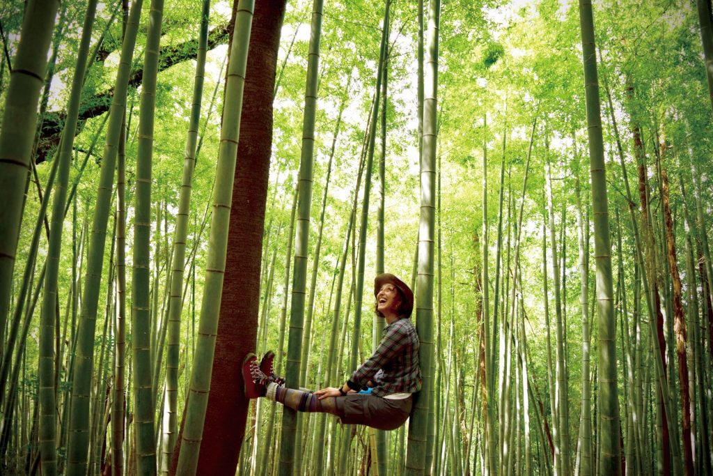
Enjoy views overlooking the ocean, parks and traditional temples and homes along the way, as well as a serene bamboo grove that is usually empty save a few locals gathering takenoko (baby bamboo shoots). If you’re feeling hungry after your hike, there are plenty of soba restaurants near Kita-Kamakura’s famous Engakuji Temple.
Getting There: Walk along the road toward the Daibutsu (Great Buddha) at Hase Station on the Enoshima Electric Railway. Five minutes down the road, you will find a flight of stairs on your right which leads to the trail.
Ten-en Trail
Another great trail in Kamakura is the Ten-en Hiking Course. It starts at the lesser-known Hansobo Shrine above Kenchoji Temple in Kita-Kamakura and continues on to Zuisenji Temple through the “Kamakura Alps.”
A little more challenging than the Daibutsu Course, the trail is easily a one-to-two-hour hike depending on your fitness, and it is mostly uphill with yagura (tomb caves) and bamboo groves mid-way. The trail doesn’t get too crowded, and there are many signs in English and Japanese along the way.
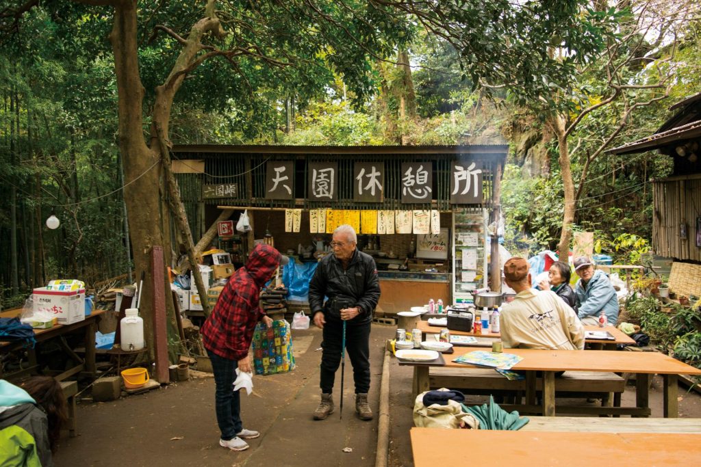
Alternatively, you could start from Kamakuragu Shrine, and in 30-40 minutes, reach the trail’s “Ten-en Trail Rest Stop,” which serves piping hot oden, tonjiru soup and cold tokoroten noodles. However, they are more famous for their yuzu-flavored daikon (radish) and tofu paired with different types of miso (soy paste).
Getting There: Kenchoji is a 15-to-20-minute walk from Kita-Kamakura Station on the JR Yokosuka Line or a 15-minute walk from Tsurugaoka Hachimangu Shrine near Kamakura Station. You can catch the bus back to Kamakura from Zuisenji Temple at Ootounomiya (15 minutes from the temple).